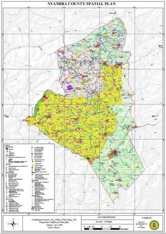
By Nyang’au Araka
Nyamira County Assembly has adopted a spatial development blueprint proposing a new airport, an agro-industrial park, upgraded roads and expanded urban centres by 2030.
The plan aims to position Nyamira as a regional agricultural, industrial and transport hub while guiding land use, infrastructure investment and environmental conservation over the next decade.
Also Read
The Nyamira County Spatial Plan (2021-2030), adopted by the Nyamira County Assembly on Tuesday, outlines a long-term framework for managing land use, infrastructure, environmental conservation and economic growth across the county’s five sub-counties and 20 wards.
County planners describe the plan as a response to mounting development pressures, including rapid land fragmentation, poor road connectivity, unplanned urban growth, environmental degradation and inadequate water infrastructure.
The document envisions “a vibrant, modern, and green county driven by economic diversity and optimal resource utilization.”
Among the headline projects is the proposed Nyamira Airport at Sironga, which planners say will support agricultural exports and complement the planned agro-industrial park.
The airport project includes passenger facilities, runways and supporting infrastructure and is expected to improve the county’s attractiveness to investors.
Another flagship proposal is the Nyamira Integrated Agro-Industrial Park, backed by the United Nations Industrial Development Organization (UNIDO).
The facility is expected to provide value addition for agricultural products from Nyamira and neighbouring counties, creating new jobs and expanding market opportunities for farmers.
“The establishment of the Industrial Park will provide a ready market for farm produce in 11 counties,” the spatial plan states, adding that the facility will focus on processing livestock, dairy, fisheries, fruits, vegetables and cereals.
The county is also banking on transport investments to unlock economic growth. The plan proposes upgrading key road corridors to bitumen standards, creating new link roads, establishing matatu termini in major centres and lobbying for a future Standard Gauge Railway (SGR) connection through the region.
Already, plans are on course to have the project, with a train station at Magwagwa in North Mugirango Constituency.

According to the plan, only about 20 per cent of classified roads in the county currently have bitumen surfaces, while poor road conditions continue to hamper movement of people, farm produce and services.
The blueprint also seeks to reorganize urban development by elevating selected growth centres and creating a hierarchy of municipalities, towns and market centres.
Under the proposal, Keroka would attain municipality status, while Kijauri, Ekerenyo/Ikonge and Manga would become towns.
The plan also places strong emphasis on environmental protection, with county planners identifying declining water levels, extensive eucalyptus planting, soil erosion and pollution of rivers as major threats.
As a result, the county proposes the gradual replacement of eucalyptus trees with indigenous species and bamboo, restoration of wetlands and rehabilitation of riparian corridors.
One of the most ambitious environmental projects is the proposed development of Nkoora Hill into an arboretum and conservancy, while tourism investments are expected around Manga Ridge, waterfalls in various parts of the county and the planned Magwagwa Multipurpose Dam.
The dam, being advanced under the Lake Basin Development Authority, is designed to generate hydroelectric power, provide irrigation water and support flood control and tourism activities.
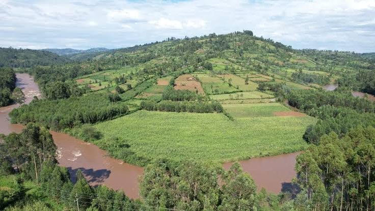
Project documents seen by this writer indicate the facility could supply clean water to Nyamira, Kisumu and Homa Bay counties while supporting irrigation on more than 13,000 hectares.
Public participation forums conducted before Assembly consideration highlighted concerns over security, chronic water shortages, poor roads and inadequate sewer systems, according to the report.
Residents also called for faster development of urban centres and enhanced investment in infrastructure.
“The chronic water problem within Nyamira Township including the Nyamira County Referral Hospital should be addressed,” members of the public told the Assembly committee during consultations.
In its review report, the County Assembly Committee on Lands, Housing and Urban Development supported the spatial plan but raised concerns over land fragmentation, outdated valuation rolls, urban planning delays and uncontrolled conversion of agricultural land.
The committee noted that “fiscal constraints have critically impeded capital execution for anchor initiatives” and warned that widespread subdivision of land was producing “economically unviable agricultural holdings.”
The committee further recommended approval of the plan, subject to several amendments, including stronger provisions for rail connectivity to the proposed industrial park and proper recognition of Nyamira University within future land-use planning.
Nyamboga Gisesa, a Member of the Nyamira County Assembly said on Tuesday that by adopting the plan, they had paved the way for implementation of one of the largest development frameworks ever proposed in Nyamira County.

Recently, Governor Amos Nyaribo noted: “The Nyamira County Spatial Plan, will guide and streamline urban development.”
Nyaribo described the plan as a major milestone in the county’s efforts to establish standards for urbanisation and pursue integrated, multi-sectoral and sustainable development.
“It is a key strategic resource mobilisation tool for sparking and spurring urbanisation,” he said.
A county spatial plan provides a framework for determining how land should be used and where development, infrastructure and investment should be located.
It also helps coordinate urban and rural development while addressing issues such as environmental conservation, transport networks and access to public facilities.
Under the County Governments Act, 2012, counties are required to prepare 10-year, GIS-based spatial plans as part of their development planning frameworks.
The plans are subject to approval by the respective county assemblies and should be reviewed every five years.

The National Land Commission’s October 2025 report on county spatial planning listed Nyamira among eight counties whose draft plans were awaiting approval by their assemblies.
At the time, 19 counties had fully approved spatial plans, while others were at different stages of preparation.
The countywide plan is intended to offer a broader spatial framework for coordinating development across the county.
Nyaribo said the process had involved several stakeholder engagements, with the latest consultations bringing together county officials, legislators and municipal leadership.
He also acknowledged the support of the Food and Agriculture Organisation (FAO), which has worked with the county on the planning process.
The plan comes amid wider efforts by county governments to manage rapid urbanisation, coordinate infrastructure development and ensure that land and other resources are used sustainably.
“The plan is set to become the county’s primary development roadmap through 2030, guiding public investments and land-use decisions worth billions of shillings across infrastructure, agriculture, urban development, water, health, education and environmental conservation,” Gisesa, who is the chairperson Public Investiments Committe (PIC) said.